
Newtown ZIP Code Directory by Area
Current official research supports two Newtown delivery ZIP codes. The USPS DMM L606 label table is the postal reference, while the Newtown Plan of Conservation and Development supplies local place names. USPS label data and municipal geography answer different questions, so the table keeps the postal place and the town areas side by side.
| ZIP | Areas Covered | Post Office | Notes |
|---|---|---|---|
| 06470 | Newtown Borough, Botsford, Hawleyville, Dodgingtown, and other Newtown delivery areas using the Newtown postal place | Newtown, Connecticut | Primary Newtown delivery ZIP; USPS label material pairs it with 06482 under the Newtown 06470 label |
| 06482 | Sandy Hook village and postal place within Newtown | Sandy Hook, Connecticut | Distinct Sandy Hook postal identity; exact current station details were not located in the USPS search |
No additional current Newtown delivery ZIP is supported by the official sources reviewed. 06487 is South Britain or Southbury postal material, and 06488 is Southbury. A container or label route can mention those numbers alongside a Newtown processing label, but that handling detail is not proof that the ZIP serves a Newtown street.
06470 Covers the Main Newtown Postal Place
06470 is the broad Newtown postal layer. It commonly appears with the Borough and with delivery areas associated with Botsford, Hawleyville, and Dodgingtown. Those names come from Newtown geography and planning documents, not from a claim that every neighborhood has a separate postal boundary. An address can carry the Newtown postal place while its parcel record uses a street, lot, or subdivision name that looks quite different.
The USPS label table is useful for confirming the postal label attached to a mailing address. It is not a parcel map and does not identify the recorded owner. For a person or property question, save the full address as written, including the postal city and ZIP, then compare it with Newtown GIS. A mailing address for an owner may be in another town even when the parcel situs is in Newtown.
That distinction matters because a postal match is only the opening filter. A record keyed to a Newtown parcel can be searched through municipal systems after the ZIP has been checked. A record keyed to a voter, court party, or vital event has its own eligibility and date rules.
06482 Keeps Sandy Hook Distinct
Sandy Hook is a Newtown place with its own postal identity. The official material describes 06482 as Sandy Hook, Connecticut, and the USPS administrative decision identifies the Sandy Hook label in the 06482-1110 form. The town and postal place should therefore be kept together in a search note without being treated as the same label as 06470.
A Sandy Hook address can still be a Newtown municipal parcel. Verify the town line and parcel location separately from the postal line. A post office label does not decide which assessor, Town Clerk, zoning office, court district, or voter registrar holds the related record. The ZIP helps route mail; the municipality controls the public record custodian.
Do not use 06482 to estimate a Sandy Hook resident count. The research did not locate an official current population, registration, or owner total by ZIP. The safe statement is geographic: Sandy Hook is within Newtown and is represented by a distinct postal ZIP in the sources reviewed.
06487 and 06488: Not Newtown ZIPs
South Britain and Southbury postal material can appear near Newtown in USPS container-label or routing documents. That proximity does not turn 06487 or 06488 into current Newtown delivery ZIPs. The official Newtown research supports 06470 and 06482 for the town’s postal coverage, with 06487 associated with South Britain or Southbury material and 06488 associated with Southbury.
This is a useful USPS caveat. A processing label describes how mail containers move through a network; a delivery ZIP describes the address label used for a destination. A search that starts from a secondary label can produce the wrong municipal office, parcel layer, or place name. Use the exact address and the USPS lookup or label reference before assigning a Newtown ZIP.
When a mailing document and a property card disagree, preserve both values. The mailing ZIP may describe an owner’s correspondence address, while the situs and MBL identify the Newtown parcel. Neither value alone is a resident directory.
Newtown ZIP Code Directory Search Fields
Connecticut Civil Inquiry is the clearest ZIP-capable public search found in the research. Its property-address search can associate a court index result with a town, street, ZIP, case type, property type, and status. It is not a complete list of residents or parcels. The image below shows the portal surface that accepts a ZIP as one part of an address-based court query.
The Civil Inquiry property-address source used for the Newtown ZIP code directory should be read with the date and case-coverage caveat.
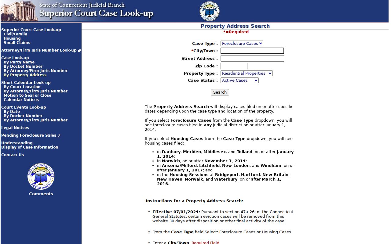
The image connects ZIP filtering to court records, not to a household count. Civil and property documents may be available online only for certain dates, and older or protected material may require a courthouse clerk.
| Field or control | Type | Required | Format or options |
|---|---|---|---|
| City or Town | Text | Yes | At least three characters; partial values are accepted |
| Street Address | Text | No | Partial street value is allowed |
| Zip Code | Text | No | Exact five-digit value |
| Case Type | Dropdown | No | Choose a case type when the question is known |
| Property Type | Dropdown | No | Residential, Commercial, or All |
| Case Status | Dropdown | No | Active, Disposed, or All |
Newtown GIS does not expose a ZIP field in its static search. It uses House No and Street, owner Name, or MBL. Vision’s dynamic assessor interface may accept location or address filters, but the live advanced controls were not exposed in the unattended capture. That is why a ZIP result should be handed to a parcel key rather than treated as a finished resident search.
Finding Newtown Residents by ZIP Code
A ZIP filter can narrow the first step, but a Newtown resident search still needs a municipal or state record that answers a narrower question. The safest order is postal verification first, parcel geography second, assessment context third, and the originating record custodian last.
- Confirm the exact mailing address and ZIP with USPS material. Record whether the postal place is Newtown or Sandy Hook, and do not substitute a nearby container label.
- Search the address in Newtown MapXpress by House No and Street. If the street spelling fails, try the portal’s exact dropdown variant or search by owner name.
- Save the parcel’s MBL, unique ID, account, situs, and owner link. An MBL is the map-block-lot key that joins a parcel to other town records more reliably than a ZIP.
- Open the Newtown Vision assessor database for the assessment card and separate the owner mailing address from the Newtown situs.
- Move to the Newtown Town Clerk for a deed, map, vital record, or request route. Use the court, voter, or DPH system only for the record type and access rule it actually controls.
Once a ZIP narrows the address to a street, the Newtown street directory workflow takes over. Street-level searching still depends on parcel, deed, voter, and record-specific limits, not on a ZIP-wide roster.
Two ZIP Labels Across Five Newtown Places
Newtown’s 2024 Plan of Conservation and Development describes five named places that help a researcher read local references: Borough, Sandy Hook, Hawleyville, Dodgingtown, and Botsford. These are planning and geographic labels, not five public resident lists. A printed notice or directory may use one of them even when a modern parcel search uses Newtown and an MBL.
In postal terms, Sandy Hook is the clear separate label in the research. Borough, Hawleyville, Dodgingtown, and Botsford commonly sit under the broader Newtown postal layer. That arrangement explains why a postal directory can be useful for orientation without becoming a boundary map. Place names survive in newspapers, old deeds, telephone directories, and local history files, while the current parcel system uses structured fields.
The Newtown POCD geography source also warns against turning planning descriptions into a ZIP allocation. Use it to understand local naming, then verify the address with USPS and the parcel with GIS.
Newtown ZIP Code Counts Need Caution
No official source in the research gives a current resident, voter, or owner count for 06470 or 06482. Do not divide a town total between the two ZIPs, subtract one estimate from another, or use a ZCTA population as a mailing-list total. The postal directory can show coverage and search paths, but it cannot support a per-ZIP number that the custodian did not publish.
Even town-level measurements differ by source. Census 2020 material gives Newtown about 27,173 residents and roughly 57.5 land square miles, while a Census QuickFacts estimate is around 28,183 for 2025. The Town welcome page gives 38,644 acres or 60.38 square miles, and the POCD gives about 37,120 acres or 58 square miles. The differences reflect source, date, and measurement method. They are not evidence of a ZIP realignment.
The research also found no Newtown-specific ZIP split or realignment year, no official address-by-address ZIP boundary file, and no current registration count by ZIP. Treat that as a real gap. For a live boundary question, ask USPS about the exact address and ask Newtown GIS about the parcel.
ZIP Codes, ZCTAs, and Newtown Town Lines
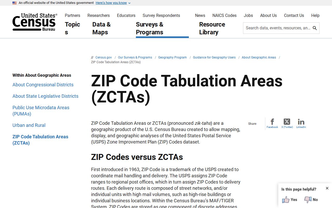
A ZIP is a postal delivery construct. It can cross a municipal line, use a postal place that differs from the municipality, or appear in a routing label that does not describe the destination. The Census Bureau’s ZCTA guidance explains that ZIP Code Tabulation Areas are approximations built for statistical reporting, not legal town boundaries.
The Census source pictured here is useful for understanding why a map shaded by ZCTA cannot decide whether a particular parcel lies in Newtown.
Use the following definitions when reading Newtown postal records.
- ZIP versus ZIP+4
- The five-digit ZIP identifies a broad delivery area. ZIP+4 adds a more precise delivery segment, but it still does not define a parcel or town boundary.
- PO-box ZIP
- A ZIP used mainly for post-office boxes or a limited delivery arrangement. It should not be treated as a list of street households.
- Unique ZIP
- A postal code assigned to one organization or focused delivery destination. The Newtown research did not identify one as a current town resident ZIP.
- Carrier route
- A delivery sequence used by the Postal Service. It is operational mail geography, not a municipal or resident-record boundary.
Newtown ZIP Search Ends at a Parcel
The practical crosswalk is USPS address and ZIP, then Newtown GIS parcel and MBL, then Vision assessment card, then the Town Clerk deed or map. From there, choose the proper state or local record system. Civil Inquiry can search a court address; SOTS can confirm permitted voter fields one person at a time; DPH controls vital copies; and the Town or state office controls a correction.
GIS layers can add zoning, school, fire, police, water, sewer, historic-district, aquifer, and FEMA context, but a layer is not a resident list. Vision supplies assessment context, but an owner mailing address may sit outside Newtown. The Town Clerk supplies recorded instruments, but the deed index does not show every person who used a parcel.
The ZIP code directory is therefore a starting filter, not a final answer. Keep 06470 and 06482 separate, mark 06487 and 06488 as non-coverage in Newtown research, save the exact postal and situs lines, and report the source date. That small discipline prevents a USPS label, a census approximation, and a municipal parcel from being mistaken for one boundary.
Cross-check rule. USPS answers the postal question, MapXpress answers the parcel question, Vision answers the assessment-card question, and the Town Clerk answers the recorded-instrument question. Use the custodian that owns the fact.