
Newtown Neighbors by Block
A block search works best when its sources stay separate. MapXpress answers the geography question, Vision supplies a tax-card view, and the Town Clerk's SearchIQS land index connects parcels through recorded instruments. The registrar's street index identifies a polling district, not a list of names. Community pages add local context, but a private association's public overview is not a member roster.
| Source | What It Shows About a Block | Access |
|---|---|---|
| MapXpress map and buffer | Nearby parcel geometry, owner or mailing clues, MBL, acreage, land use, zoning, and coordinates | Public map; choose and record the distance |
| Vision assessment cards | Card-by-card owner, mailing, assessment, building, and sale-reference fields | Public dynamic portal; open each card |
| Town land records | Transfers, easements, plats, and legal descriptions tying parcels together | SearchIQS guest index; images or older books through the Clerk |
| Registrar street index | Polling district and street assignment around the address | Town registrar route; not a name roster |
| POCD and neighborhood pages | Planning geography for Borough, Sandy Hook, Hawleyville, Dodgingtown, and Botsford | Public planning material; no resident list |
| Association pages | Community purpose, public notices, board or contact material | Public overview; member areas may be private |
| Building, Land Use, or FOI file | Releasable permit, application, parcel, and date clues | Counter or focused request; no complete online index located |
Owners, mailing addresses, and occupants are not interchangeable. A parcel card can identify a recorded owner whose tax notices go somewhere else. A voter result can identify one registration without revealing household members. Read a neighbor result as a source-specific clue, then confirm the question with the office that created the record.
Open a Newtown Block Map
Use the Newtown MapXpress interactive parcel map to move outward from one known parcel. The map's Parcel Information, Pan, Select, Full Town View, Reset Map, legend, extent, and measurement tools support a visual block check. The point is to identify nearby polygons and then inspect each record, not to infer a household from the shape of a lot.
- Find the starting address or MBL and open its parcel detail. Save the street, location, house number, unique ID, account, and MBL.
- Pan and zoom to the surrounding polygons. Click each parcel that appears adjacent or close, and note whether a road, water feature, or lot line separates it.
- Open the owner or assessor link for each selected parcel. Keep the situs and any mailing address in different notes.
- Write down the map date, layers used, and distance chosen. For a full named-street chain, use the Newtown street directory address workflow instead of treating a radius as the whole street.
The map can also show zoning, land use, FEMA, open space, trails, soils, contours, aquifer, police, fire, water, sewer, historic-district, and school-district layers. Those layers explain the block's civic setting. They do not add private names to the map.
The captured Newtown GIS view shows the public parcel interface that supports this address-to-block method.
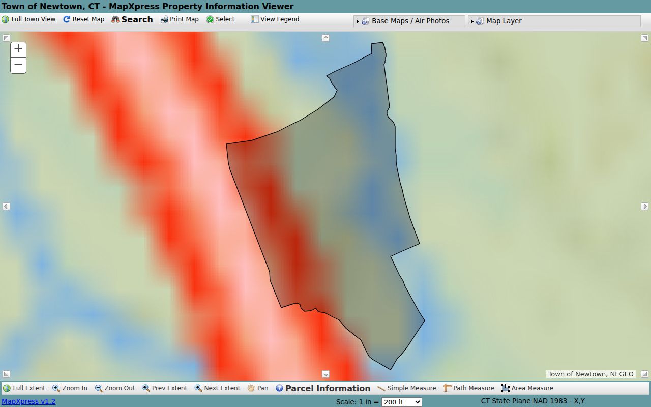
Use the image as a visual reminder to start at a selected parcel and inspect the surrounding geometry one lot at a time.
The Newtown 100-Foot Buffer
MapXpress parcel detail includes a Generate Mailing List action with a distance field that defaults to 100 feet. That buffer is a geometry query. It asks which parcel shapes intersect the chosen distance and can return owner or mailing-list material tied to those parcels. It does not query the voter roll, verify occupancy, or find every person who regards the address as a neighbor.
Distance matters. A lot across a road may feel adjacent but fall outside a small buffer. A large parcel may touch the chosen shape even when its home is farther away. A road centerline, water edge, or irregular boundary can change the result. Always pan across the map after running the buffer and state whether the query used 100 feet or another value.
MapXpress property information is reported as nightly data, and the parcel maps were updated in January 2026. A buffer result is therefore a dated research snapshot. Save a Quick Map, Print Map, or assessor-map link when the block view needs to be checked later.
Note: A buffer result identifies nearby parcels, not a complete list of Newtown neighbors or a legal boundary between properties.
Compare Newtown Parcel Fields
The parcel detail page gives a consistent set of fields for comparing nearby lots. The most useful fields are OWNER_NAME, STREET, LOCATION, HOUSE_NO, MBL, UNIQUE_ID, ACCOUNT, ACRES, LAND_USE, ZONING, LAT, LON, COMPLEX_NAME, and linked map or property-card documents. Compare the physical location and parcel identifiers before comparing names. A mailing address is a tax-notice clue, not a measure of which lot touches the block.
The Newtown GIS parcel-detail example shows the kind of card produced after a parcel click.
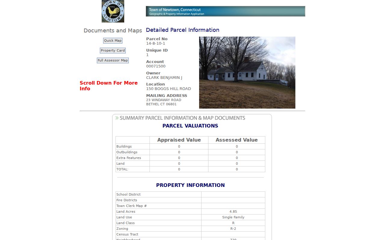
That detail view includes a parcel number and unique ID, account, owner name, situs and mailing fields, MBL and GIS link, acreage, land use, zoning, coordinates, map PDFs, and a property-card path. A captured sample pairs a Newtown situs with a Bethel mailing address, which is why both values must be saved separately. The sample card is not a public block roster.
- Situs
- The physical parcel location used by the map and assessment layer.
- MBL
- A map-block-lot identifier that helps connect a parcel to a deed, map, or assessment record.
- Owner field
- The recorded tax-roll name or link shown by the parcel source, not proof of current occupancy.
- Buffer
- A chosen distance around a parcel used to find intersecting or nearby geometry.
Newtown's Five Planning Places
The Newtown Plan of Conservation and Development gives five place names that help a reader understand why a block may be described by a village or neighborhood label. These are planning and geographic categories, not five public resident directories. They can be useful when a road name in an older notice or community page does not match the town name used in a parcel portal.
- Borough: the central historic neighborhood and civic center.
- Sandy Hook: the eastern village or neighborhood, with its separate 06482 postal identity.
- Hawleyville: a northwestern area with rural lots and a mixed-use corridor near I-84.
- Dodgingtown: a western, largely residential area associated with larger lots and the Hattertown Historic District.
- Botsford: a southern area with older and newer large-lot patterns near Route 25.
Use those names as search variants, then return to the street, parcel, MBL, and deed fields for the actual record link. A planning place can describe the setting around a parcel without identifying who lives on it.
Newtown Woods and Shady Rest
Community associations add a human layer to a Newtown block, but public pages and private member areas serve different purposes. Newtown Woods offers a public overview and a resident-restricted area. Shady Rest provides public association and board material for its Lake Zoar and Sandy Hook community. Neither public source supplies a member roster. A public notice or board contact can explain how to ask a community question, but it should not be turned into a list of nearby households.
The Newtown Woods public association page is the source for this community context.
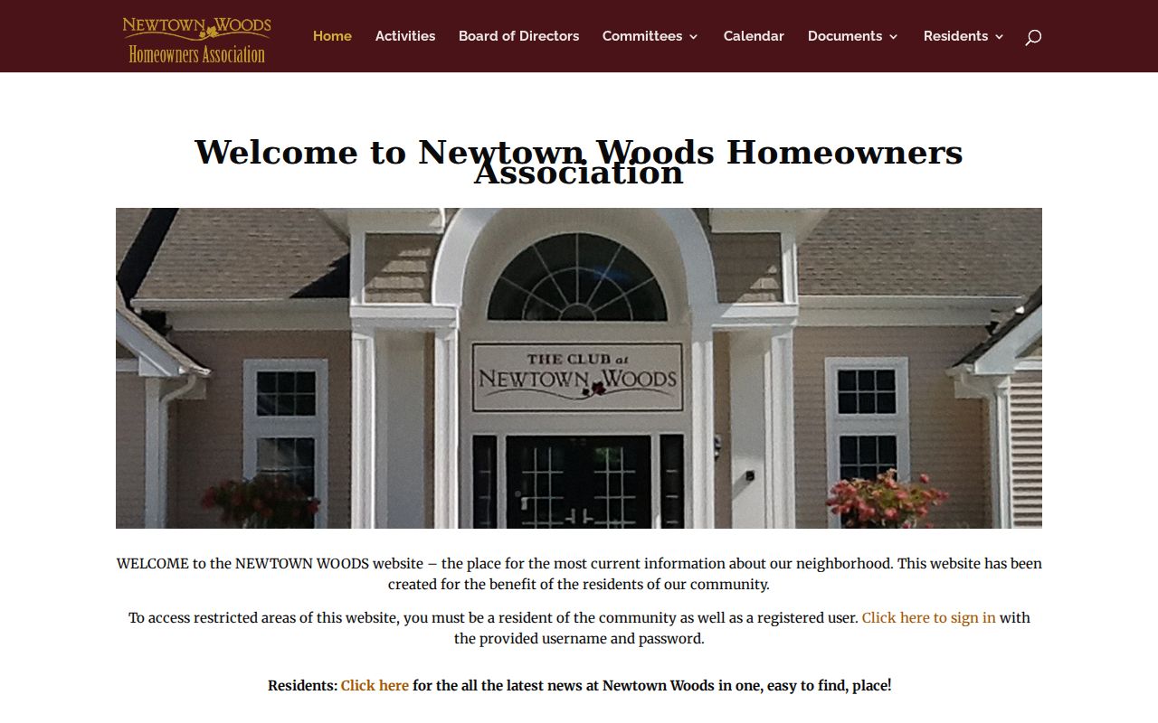
The public material can establish that a community has an information page and a restricted resident area. It does not establish which Newtown addresses belong to individual members.
The Shady Rest Association public page provides a second local example of public community material without a public member directory.
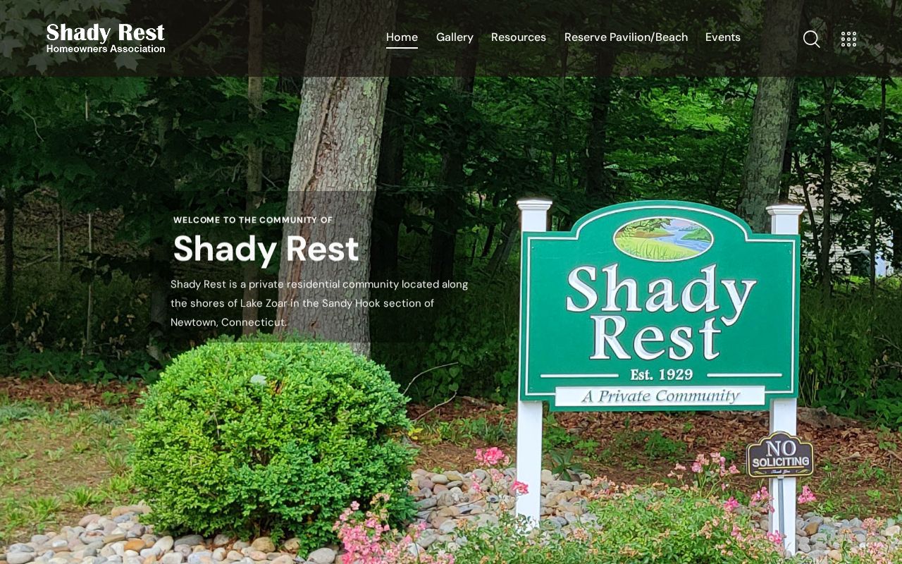
Use the page for public board, meeting, or community information only. If a question concerns a specific parcel, the GIS, assessor, or Town Clerk record is the better source for the parcel fact.
Association Records in Newtown
Newtown's zoning regulations create a narrow official route for association records. Common-interest community officers and addresses are filed with the Zoning Enforcement Officer initially and annually, while declarations and amendments are recorded with the Town Clerk. That filing route is not the same as a member list. It can help confirm an association name, officer record, or recorded declaration when a public web page is silent.
Ask the ZEO or Town Clerk for a specific association record, filing year, declaration, amendment, officer filing, or parcel reference. A focused request is more useful than a request for every person connected to a community. The Newtown Town Clerk is the local custodian for recorded land documents and the place to confirm the proper book, map, or request route. Connecticut's Freedom of Information process can provide access to releasable agency records, subject to exemptions.
Public boards and civic pages can identify appointed residents or meeting topics, but they are not block rosters. Keep community association material in the context layer, then use the parcel and deed layers for the property question.
Voter Visibility Around Newtown Blocks
A map radius does not unlock a block-level voter list. The Newtown district street index can show which polling district and street grouping apply. The official Connecticut voter lookup is intended for an individual, using Town, name, and a date-of-birth field. A result may confirm registration, residence or polling information, party or status, and district details. It does not reveal ballot choices or every person at an address.
The Secretary of the State describes a separate full-file request. The CSV costs $300 and comes with a written attestation limiting use to election-related, scholarly, journalistic, political, or governmental purposes. Month and day of birth are withheld from public release, and protected voters may have street or house addresses suppressed. The Connecticut voter privacy page explains why a block map and a voter record cannot be combined into an unrestricted neighborhood roster.
Use one registration result only as a dated, source-specific clue. If the question concerns a district, contact the Newtown registrars. If it concerns a protected address or a full file, follow the Secretary of the State's current process rather than trying to infer missing fields.
Official Records and Neighbor Tools
Official Newtown records and unnamed commercial neighbor-search tools may both present a name near an address, but they do not carry the same meaning. The official route points back to a custodian, a record type, and a date. A compiled tool may combine parcel, directory, and purchased data into a profile, and its entries may be stale, conflated, or difficult to trace to an underlying record.
| Question | Official Newtown record | Commercial category |
|---|---|---|
| Where did the fact come from? | GIS, Vision, Town Clerk, registrar, court, library, or association custodian | May combine several sources without a clear record path |
| What does an address mean? | Situs, mailing, voter residence, legal description, or publication address is identified by source | Different address types may be blended into one profile |
| How can it be checked? | Use the MBL, book/page, portal result, filing date, or office contact | Corrections and removal steps vary; an underlying record may remain unchanged |
| What stays out? | Protected voters, utilities, DMV data, sealed files, and private member lists remain restricted | A compiled page is not permission to obtain or publish restricted data |
For family history, a civic question, or a property concern, return to the official source. The record's limits are part of its meaning, not a defect to be filled with guesses.
Privacy Limits for Newtown Neighbors
Newtown neighbors are not a public household index. Other household members and occupants may not appear on the tax card. Utility subscribers, delivery records, and DMV address data are not public shortcuts. Court, vital, adoption, juvenile, victim, sealed, and expunged material can be restricted, and Connecticut's Address Confidentiality Program can replace a protected participant's actual mailing address with a substitute address.
Lawful use. Use a neighbor lookup for personal research, family history, community context, or personal safety awareness. Do not use parcel or voter clues to stalk, harass, intimidate, or publish a protected person's information.
If a record appears inaccurate, contact the originating custodian with the parcel, MBL, filing, registration, or publication date. A current owner is not automatically a current occupant, and a nearby parcel is not automatically a social or household connection. Careful source matching protects both the research and the people named in it.